9 Hiking trails to hit which are NOT Mount Fuji (Part 2)

Japan offers some of the best spots for hiking and provides some of the most beautiful sights for you to see. Welcome back to part two of Japanese hiking trails which are NOT Mount Fuji (富士山 Fujisan). Earlier, I introduced five fun hiking trails that you should check out in the northern half of Japan. In the final part of this two-part series, we will cover hiking trails in Chugoku, Shikoku, Kyushu, and Okinawa. Without further delay, let us begin with our adventure!
6. Chugoku (中国): Mount Daisen

Mount Daisen. (Image credit: photoAC)
We begin part two of the series by heading up to the highest point of Chugoku, which peaks at a height of 1,729m. While trekking in this trail, you will come across bounds of beech and yew trees. Be greeted with sprawling views of Tottori (鳥取県 Tottori-ken) as you immerse yourself in the spiritual energy Mount Daisen (大山) offers: long used by the Yamabushi (山伏)—Japanese mountain ascetic hermits—as a spiritual training ground, hikers are invited to seek solace in the multiple shrines and temples which dot the trail. Nearby Mount Daisen also lies the beautiful Shoji Ueda Museum of Photography (植田正治写真美術館 Ueda shōji shashin bijutsukan) which epic architecture cleverly incorporating the landscape of Mount Daisen is an experience not to be missed.

Mount Daisen. (Image credit: photoAC)
Mount Daisen (大山)
Address: Daisen, Saihaku District, Tottori 689-3318, Japan
Nearest station: Yonago Station
Tel: +81-859-52-2502
7. Shikoku (四国): Iya Valley

A bird's eye view of Iya Valley from the popular vantage point of the Peeing Boy Statue. (Image credit: photoAC)

Iya Valley’s vine bridges. (Image credit: photoAC)
Located deep within Tokushima Prefecture (徳島 Tokushima-ken), Iya Valley (祖谷渓 Iyakei) is known for its amazing valleys, mountainside hot springs, and the historical Ochiai Village (落合集落 ochiai-shuraku). Traditionally the Japanese would cross the mountains and valleys using vine bridges. Visitors to the Iya Valley will have the chance to cross the Iya-Kozurabashi (祖谷かずら橋) and Oku-Iya Kozurabashi (奥祖谷二重かずら橋) bridges, which are considered some of the more popular tourist spots.

Hiking on Mount Tsurugi. (Image credit: photoAC)
Iya Valley is also home to Tokushima’s tallest mountain Mount Tsurugi (剣山 Tsurugi-san), which offers easy to moderate hiking trails for beginners and novices alike to try out. It's a 15-minute lift ride to the top where most of the hiking trails start, and the peak can be reached in an hour's hike.

The Ochiai-Shuraku. (Image credit: photoAC)
Also part of the Iya Valley is the Ochiai Village which is a preserved district with ancient constructs that date back well over 200 years. If you are looking for a place to lodge overnight for the full historic experience, there are eight thatched roof houses of Togenkyo-Iya (桃源郷祖谷) in the village available, all of which are beautifully refurbished and refurnished with modern kitchens.
Iya Valley (祖谷渓)
Address: 166 Nishiiyayamamura Nakao, Miyoshi-shi, Tokushima 778-0102
Nearest stations: Awa-Ikeda Station (阿波池田駅) / Oboke Station (大歩危駅)
8. Kyushu (九州): Mount Aso

Mount Aso. (Image credit: photoAC)

Crater of Mount Aso. (Image credit: photoAC)
Next we head to Kyushu to conquer Mount Aso (阿蘇山 Aso-san), which is Japan’s largest active volcano located in the center of Kyushu. Mount Aso most recently erupted in 2016, and being an active volcano you are guaranteed a treat for your eyes in the form of a spectacularly diverse landscape filled with grey rocks, crevasses and a smokey caldera, likening Mount Aso to that of the moon. Within the craters unique minerals have transformed the hot springs into a milky colour which adds to the otherworldly view. Fulfill all your dreams of starring in a Star Wars/Star Trek film by hiking on one of Mount Aso’s awe-inspiring trails.
Mount Aso (阿蘇山)
Address: Mount Aso, Takawara, Aso, Kumamoto 869-2223
Nearest station: Aso Station (阿蘇駅)
Tel: +81 967-34-1600
9. Okinawa (沖縄) : Mount Omoto

Mount Omoto. (Image credit: photoAC)
If you’re seeking a peaceful respite from the bustle of life, this secluded one might just be up your alley. We will now head to Mount Omoto (於茂登岳 Omoto-dake), Okinawa’s highest mountain, which stands at 525.5m (1,724 ft) above sea level, and is also the source of two vital rivers (Miyara and Nagura) which provide Ishigaki Island (石垣島 Ishigaki-jima) with its main drinking and agricultural water. The upward hike might be challenging for travellers who are not accustomed to steep slopes or climbing a huge flight of stairs, but we guarantee that the sweat and (possible) tears will be worth it. Offering a different tropical visage as compared to the Japanese mainland, enjoy a waterfall on your way up and be rewarded with a sprawling overlook of Ishigaki Island.
The hike up to the summit takes about 90 minutes to 2 hours on average—and just a friendly piece of advice, please do not attempt the hike under rainy conditions, as it may turn into a slippery mud bath. Safety first!
Mount Omoto (於茂登岳)
Address: Mount Omoto, Fukai, Ishigaki, Okinawa 907-0451
Nearest bus station: Omoto Bus Stop
Bonus: Shikoku Pilgrimage

Beautiful sights along the pilgrimage trail. (Image credit: photoAC)

Walk the path of pilgrims who have come before you. (Image credit: photoAC)
BONUS TRAIL, just for you! Cheated slightly on this, as it isn’t really a hiking trail per se. It’s more accurately a mish-mash of trails which connects the 88 ‘official’ temples and sacred sites which have been designated as milestones along the Shikoku Pilgrimage (四国遍路 Shikoku Henro). Specially designed to provide spiritual seekers and adventure lovers an immersive experience of Shikoku’s nature and culture, this is a journey not to be missed if you are searching for a truly rejuvenating trip of a lifetime. Completing the entire pilgrimage on foot will take one about six weeks (covering an average of 30km/day) but there’s really no hard and fast way to complete it. Many travellers cover select parts of the pilgrimage (made easy with the multiple resources offered on their website) and public transport is always available as an alternative! But the truest, most authentic form is by good ol’ fashioned walking—certainly one to consider for the bucket list.
Shikoku Pilgrimage (四国遍路)
Nearest stations: Tokushima Station, Takamatsu Station, Matsuyama Station, Kochi Station
For maps of the different courses: Refer here
We’ve made it—ten AMAZING hiking trails to fill up your bucket list when travel to Japan finally reopens! I’m so excited to give these a try. My calf muscles are fired and ready to go (but the furthest I’ve been hiking to these days is to the fridge in my kitchen on Work-From-Home days).
Time to start training up in preparation for days and days of nature and the Japanese fresh air! Until then, I will be eyeing my nearest Decathlon and keeping a list of all the hiking gear I’ll need to get. Happy dreaming, present readers. Happy hiking, future readers.
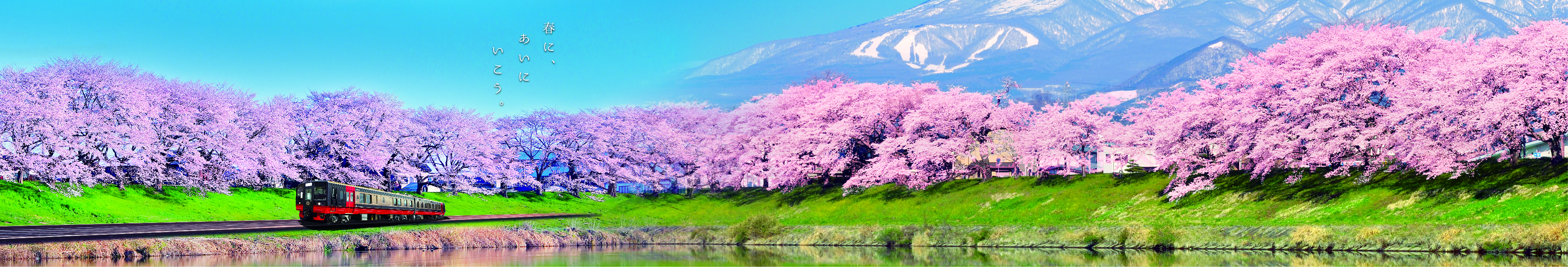
Header image credit: photoAC
Related Articles

Celia Lim
Latest Topics